How do you measure a military footprint? In people? Dollars? Space? This website is an ongoing attempt to map one aspect of that question -- by visualizing the location of United States military installations.
The data comes primarily from the 2013 Base Structure Report, with a couple of lesser-known sites unearthed by journalists and geographers mixed in as well. Many places are missing, so please let me know what else needs to be added: josh@joshbegley.com.
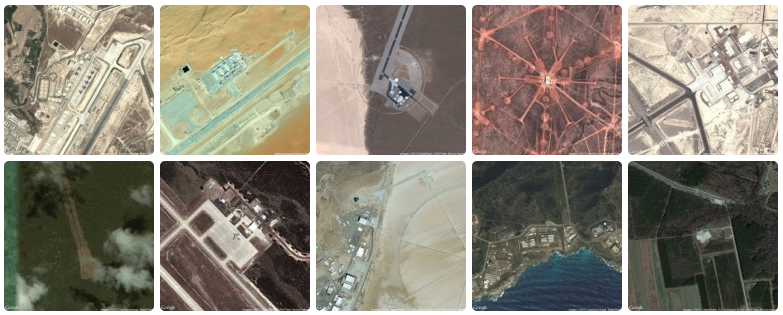
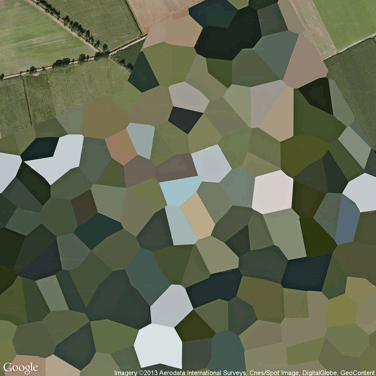
Making a map of US military installations. Here's what a bunch of them look like from above: http://t.co/iZJse5SsqL
— Josh Begley (@joshbegley) December 5, 2013In addition to the map -- which is built using MapBox, an open source and user-friendly publishing platform -- I've included snapshots of the earth's surface at various latitudes and longitudes. What does a military base look like from above? Which installations are secret and which can be viewed on the open internet? Running a small Processing sketch to query the Google Maps and Bing Maps APIs, I grabbed a satellite image for each point and am displaying the collection as a simple lightbox gallery. (H/t to @blprnt for helping me with the prototype last year.)
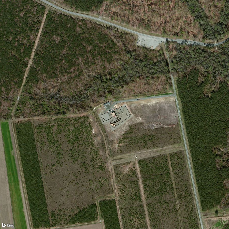
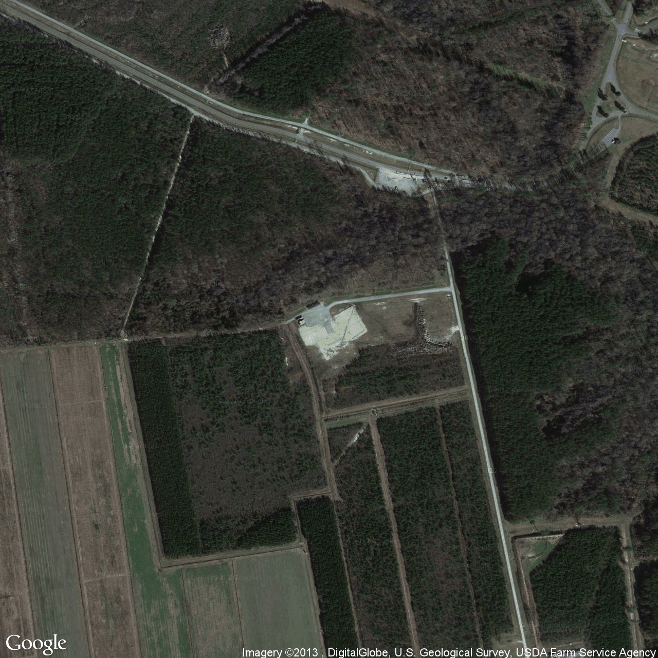
Due to the nature of commercial satellite imagery, some of the photographs have subtle differences. For example, Bing's version of Harvey Point shows a training facility being constructed to resemble Osama Bin Laden's house in Abbottabad. On Google Maps, the North Carolina structure has already been destroyed.
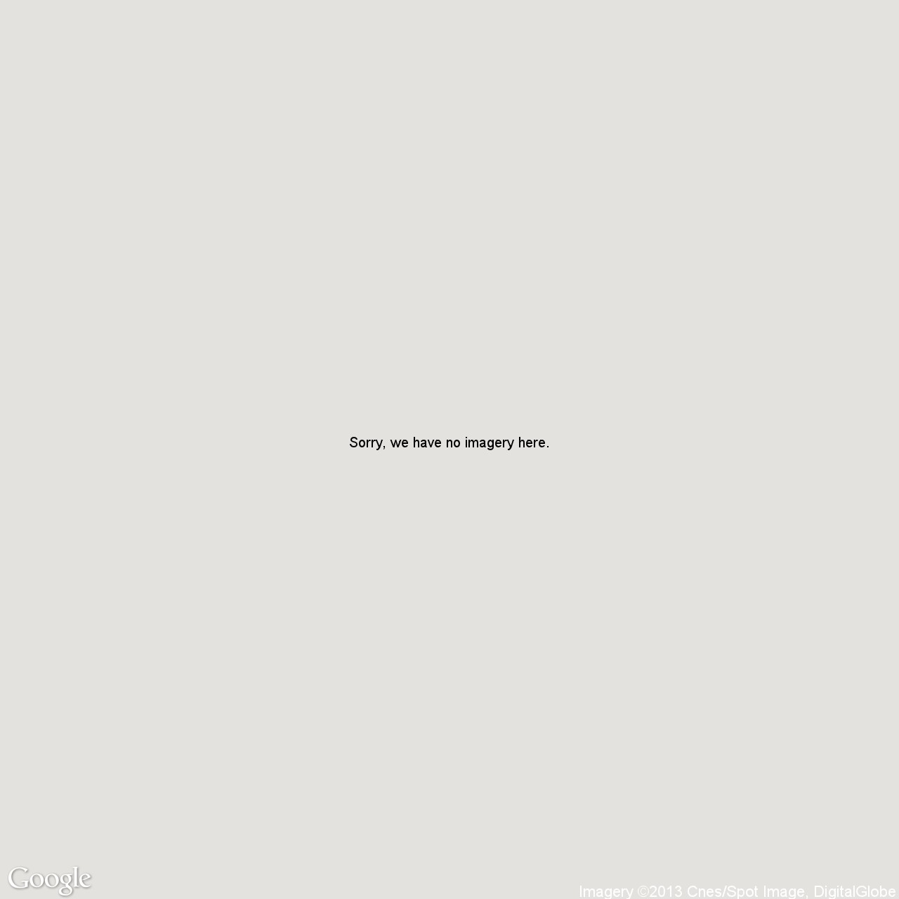
Or the secret drone base that Wired uncovered in Saudi Arabia? You can still see it on Bing. When given the same coordinates, Google returns a tile that reads: "Sorry, we have no imagery here."

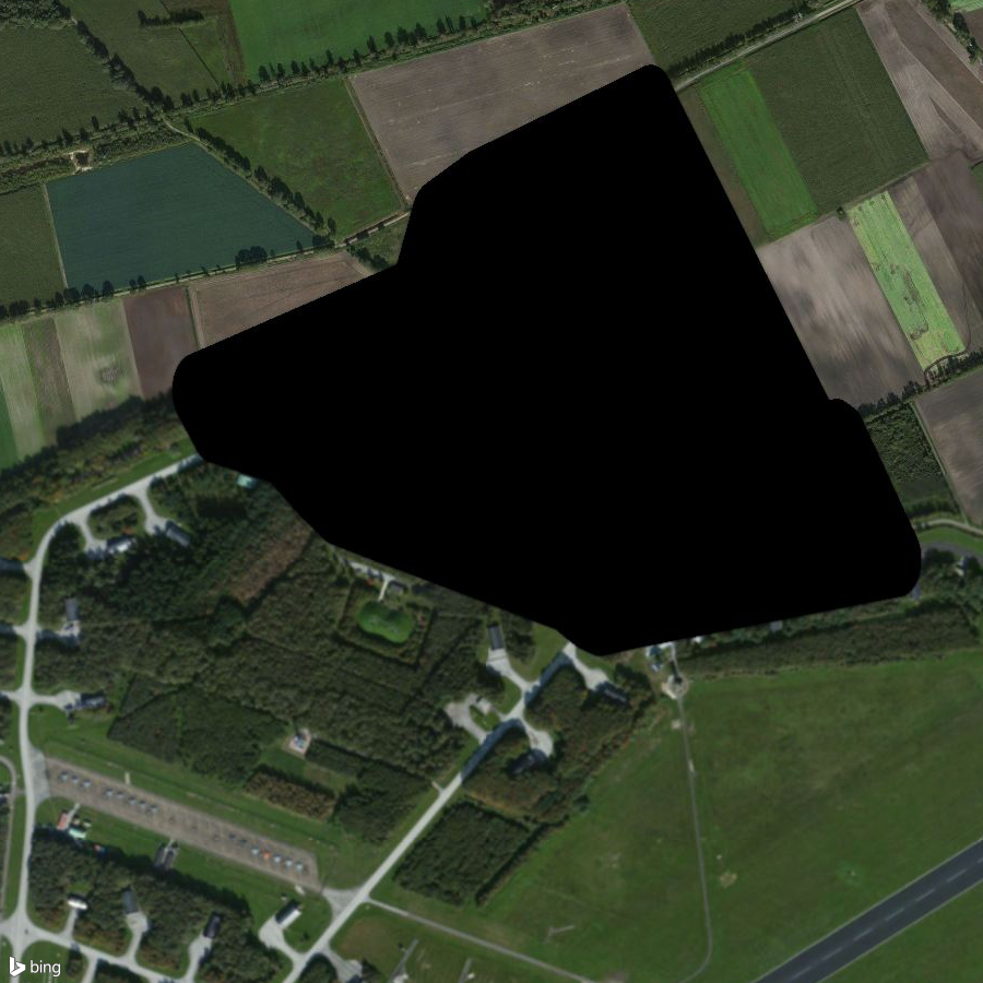
One of the few places I've seen visibly modified is Volkel Air Base. Both search engines offer quite artistic renderings.
Beyond just adjudicating the differences between publicly-available satellite images, however, I wanted to start this project to think more broadly about mappable space. In the age of APIs, how might we see secrecy in aggregate? What would an aerial display of NSA data centers look like? (Pretty mundane, I imagine.) Setting aside the fact that both Bing and Google license most of their satellite content from DigitalGlobe, I'm curious about the process by which imagery gets removed from public-facing archives. (There are apparently resolution quality restrictions in place for US satellites -- and when the young man in Richmond was spotted alongside the train tracks last month, Google said it would take "eight days" to replace the image -- but I haven't seen many examples of those restrictions in practice.)
Taken as a whole, I'd like to think this collection can begin to approximate the archipelago of militarized space often understood as empire. But I'm hesitant to say that. It seems to me that empire involves more than pushpins on a map. It is made up of human activity -- a network of situated practices that preclude constellational thinking and sculpt geographies in their own image.
I'm not sure aerial photography can get at that complexity. But perhaps an outline of this footprint-- of runways and bases and banal-looking buildings -- might begin to chip away at the bumper-sticker simplicity much political discourse about the military-industrial complex gets reduced to.
A friend recently sent me this passage from Ananya Roy that I've come to like quite a bit:
The time of empire is war and destruction, but it is also creation, beauty, and renewal. The apparatus of empire is the military, but it is also architecture, planning, and humanitarian aid. The mandate of empire is to annihilate, but it is also to preserve, rebuild, and protect. Empire rules through coercion and violence, but it also rules through consent and culture.
Check back on the site as more locations get added. In the meantime, let me know if you notice something that's missing.
***
PS: There are lots of other projects worth checking out on this thread. Bill Rankin and Rebecca Solnit have made beautiful maps. James Bridle has done pioneering work around landscapes and the drone's-eye view. Mishka Henner has examined Military Outposts and Dutch Landscapes. And if you're curious about the geography of secrecy, I would highly recommend Trevor Paglen's Blank Spots on the Map. I return to it often.